-40%
Maps POLAND Posen Breslau Warsaw Danzig Brest Katowice Breslau Pope John Paul II
$ 4.74
- Description
- Size Guide
Description
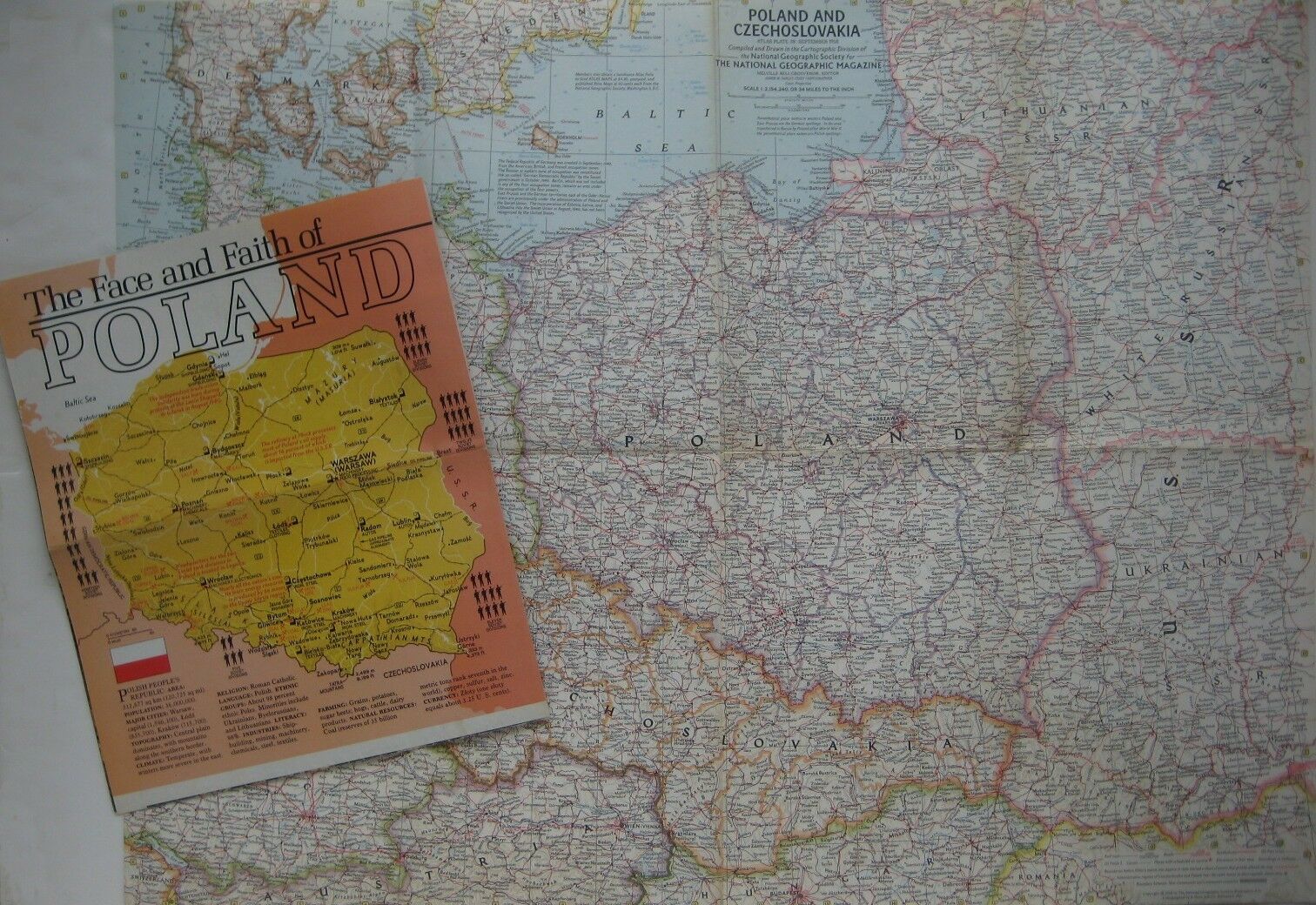
Two fold-out color lithographed maps of Poland, with great detail and hundreds of place names:The map of Poland and Czechoslovakia was issued in September 1958, opens to 19" x 25", and is drawn on a scale of 34 miles to one inch.
It identifies the political boundaries that existed before Hitler's march into Austria in 1938 and locates railroads, highways, canals, oil fields, oil pipe lines, and air fields.
For many Polish towns, the map provides alternate German or Russian spellings, and among the named places and features are Poznan (Posen), Wroclaw (Breslau), Brzeg (Brieg), Sosnowiec, Katowice, Chernyakhovsk (Insterburg), Grodno, Brest, Stalowa Wola, Lublin, Bydgoszcz (Bromberg), Warszawa (Warsaw), Radom, Kielce, Szczecin (Stettin), Gdansk (Danzig), Minsk Mazowiecki, Kraców, Czestochowa, Nysa (Neisse), Dzierzoniów (Reichenbach), Praha (Prague), Bratislava (Pressburg), L'vov, Vladimir Volynskiy (Wlodzimierz), Bydgoszcz (Bromberg), Masuria, Karlovy Vary (Karlsbad), Kaliningrad (Königserg), Miskolc, Brno, Kwidzin (Marienwerder), Oswiecim — near the Auschwitz and Birkenau concentration camps, Ostrava, and hundreds more.
The second map is titled
The Face and Faith of Poland
is primarily pictorial, with photos and text accompanied by a small map.
It unfolds to 23" x 38" and was issued in April 1982.
It delineates the nation's geographical evolution, as Poland's political borders shifted this way and that over the past 1000 years, and identifies the great figures of the country's culture and history, including Copernicus, Chopin, Madame Curie, and Pope John Paul II.
The map was issued shortly after the government forcibly suppressed the Solidarity trade union movement. Led by shipyard electrician Lech Walesa, Solidarity ultimately prevailed, however, as this map prophesied.
Both maps were published by the National Geographic Society, noted for its outstanding cartography and high-quality printing.
Condition:
They are both in
excellent condition,
bright and clean, with
no
marks, rips, or tears. Please see the scans and feel free to ask any questions.
Buy with confidence! We are always happy to combine shipping on the purchase of multiple items, and we are pleased to offer these two historic fold-out maps as
one lot.
Powered by SixBit's eCommerce Solution
